Kinshasa (Kinshasa City)
 |
Founded and inhabited by the Teke people or Humbu people, the fishing village of Kinshassa, also spelled Kinchassa, was located at the river Congo before the arrival of the European colonialists. The word nshasa translates as "marsh". Henry Morton Stanley founded the station next to it after signing a treaty with the Teke chief Ntsuvila in the later half of the 19th century. It was linked by steam boat with other stations along the river and the Stanley Pool. With the foundation and expansion of neighbouring Léopoldville Station, it became, along with Barumbu, Gombe and Lingwala, part of the city in the beginning of the 20th century.
In the 1940s it was linked to the historic heart of Léopoldville, now located at Kintambo, by the boulevard du 30‑Juin. With the Africanization program initiated by President Mobutu in 1966, the name of the entire city was changed to Kinshasa, based on the original village.
The area is now home to several institutions of the city of Kinshasa, such as the Central Market of Kinshasa, the Somba Zikita Market, and the zoological garden.
Map - Kinshasa (Kinshasa City)
Map


Country - Democratic_Republic_of_the_Congo
 |
 |
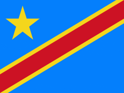
| Flag of the Democratic Republic of the Congo | |
Centered on the Congo Basin, the territory of the DRC was first inhabited by Central African foragers around 90,000 years ago and was reached by the Bantu expansion about 3,000 years ago. In the west, the Kingdom of Kongo ruled around the mouth of the Congo River from the 14th to 19th centuries. In the northeast, center and east, the kingdoms of Azande, Luba, and Lunda ruled from the 16th and 17th centuries to the 19th century. King Leopold II of Belgium formally acquired rights to the Congo territory in 1885 and declared the land his private property, naming it the Congo Free State. From 1885 to 1908, his colonial military forced the local population to produce rubber and committed widespread atrocities. In 1908, Leopold ceded the territory, which thus became a Belgian colony.
Currency / Language
| ISO | Currency | Symbol | Significant figures |
|---|---|---|---|
| CDF | Congolese franc | Fr | 2 |
| ISO | Language |
|---|---|
| FR | French language |
| KG | Kongo language |
| LN | Lingala language |